Activity: Map Scales and Distance
Maps, drawings and models are smaller than real life, so we use a scale to show how distances compare.
In this activity we'll:
- Calculate real distances using a map or model scale
- Work out the scale of maps, scale drawings or models as ratios
What's a Scale?
A scale compares distances on a map or model to real-life distances.
It is a ratio showing how much smaller (or larger) the drawing is than real life.
For example:
- A scale of 1 : 100 means 1 unit on the drawing represents 100 units in real life
- A scale of 1 cm : 1 km means 1 centimeter on the map represents 1 kilometer in real life
Scales can be shown in different ways:
- As a ratio (such as 1 : 50 000)
- As words (such as "1 cm represents 500 m")
- Using a scale bar on a map
Activity 1: Using a Map Scale
Example: Measuring distance on a map
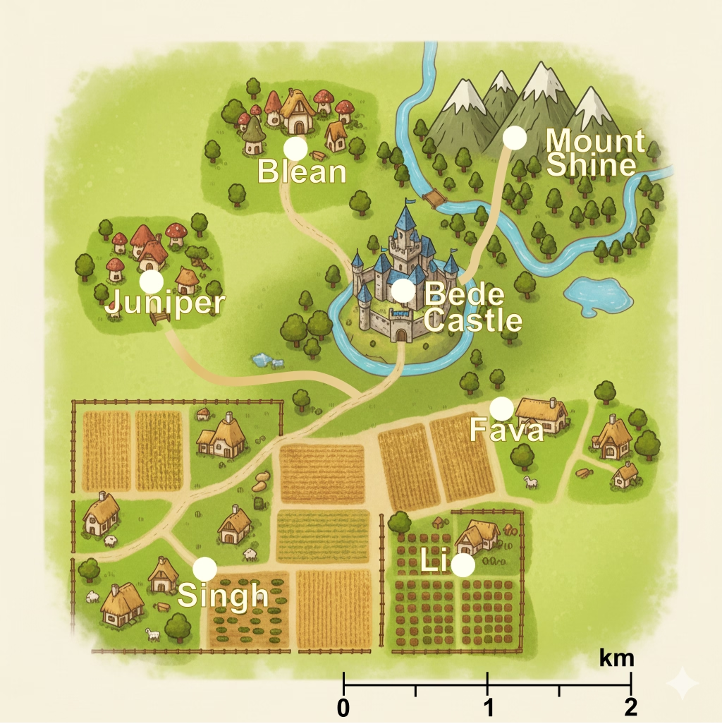
Using the scale at the bottom right of the map:
- Direct Distance: What's the straight-line distance between Juniper and Bede Castle?
- Road Distance: What's the road distance between Juniper and Bede Castle?
- Multi-stop Journey: A traveler goes from Blean to Bede Castle, then down to Fava. How many kilometers did they travel in total?
- Day Out: The Singh family want to visit Mount Shine, how far is the journey?
- Fixed Distance: The Fava family want to go for a 2km walk, where can they go?
- Real-world Math: If you walk at 4 km per hour, how long would it take you to walk from Singh farm to Li farm?
Activity 2: Finding the Scale
Sometimes the scale is missing and we need to work it out.
Example: Finding a scale as a ratio
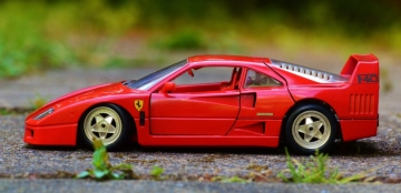

A model car is 10 cm long. The real car is 4 m long.
First let's convert to mm:
- 10 cm = 100 mm
- 4 m = 4000 mm
Now write the scale:
100 : 4000 = 1 : 40
The scale of the model is 1 : 40.
Your Turn
Find a model of a car, animal, ship, or anything really.
- Measure its length or height
- Find what the real object's length or height is
- Convert them to the same unit
- Work out the scale
Check your units and think about whether your answer is reasonable.
Always convert to the same unit before working out a scale.
Try These
The real road is 2.5 km long.
What's the scale of the map?
The real building is 15 m tall.
What's the scale?
Activity 3: Use a Real Map
Now try using a real map:
- A local street map
- A map of a place you want to go on holidays
- A map of a country you want to visit
Steps:
- Find the scale on the map
- Measure a distance with a ruler
- Calculate the real distance
- Ask: Does this answer make sense?
Extension
Create your own map of a park, or a land of your own imagination.
- Choose a scale
- Draw the map carefully
- Swap maps with someone else and calculate distances
To help draw a map we can use the "Grid" method:
- Step 1: Draw a grid of 1 cm × 1 cm squares
- Step 2: Decide what each square represents (maybe 1 cm=10 meters)
- Step 3: Draw features (ponds, trees, paths) based on those measurements